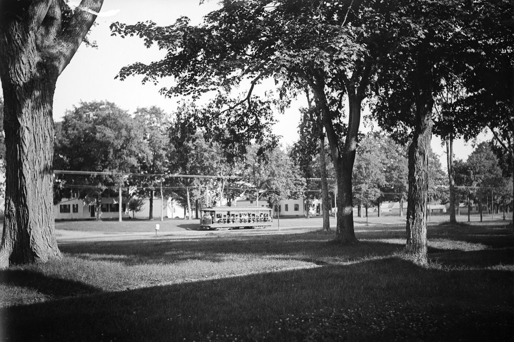
The view looking southeast toward the intersection of Longmeadow Street and Emerson Road, sometime around 1902-1909. Image courtesy of the Longmeadow Historical Society, Paesiello Emerson Collection.
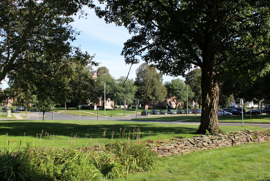
The scene in 2023:
These two photos were taken from the front yard of the Josiah Cooley House, looking southeast across Longmeadow Street. The top photo was taken by amateur photographer Paesiello Emerson, who lived in the Cooley House, and it is one of the many images that he captured of early 20th century Longmeadow.
The top photo shows a trolley traveling northbound on Longmeadow Street. At the time, trolley tracks ran the length of the street from the Connecticut state line in the south, to the Springfield border on the north. The tracks were operated by the Springfield Street Railway, and this provided direct service from Longmeadow to Springfield. Passengers could also take the trolleys south to Hartford, so this section of track in Longmeadow provided an important link in the interurban trolley system between these two major cities.
The trolley was a sign of changing times here in Longmeadow. Throughout the 19th century, the town had remained a small agricultural community, with very little development aside for the houses that lined either side of Longmeadow Street. However, the arrival of the trolley line meant that people could now live in Longmeadow and easily commute to Springfield, so by the early 20th century many of the old farms were being subdivided into residential streets.
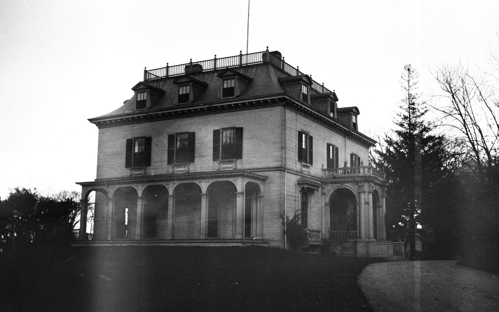
On the other side of Longmeadow Street in the top photo, several old houses are visible through the trees. It’s hard to say whether this was a deliberate juxtaposition on Paesiello Emerson’s part, to show the modern trolley with a backdrop of old farmhouses, but the photo certainly has that effect. These two houses, which once stood on the east side of Longmeadow Street just south of Bliss Road, were likely built at some point in the 18th or early 19th centuries, but both would disappear within the first few decades of the 20th century.
The house further to the right, just beyond the trolley, was the first to go. Its presence in the photo helps to establish the date that it was taken, because the house was demolished by about 1909, when Springfield-based heating and plumbing contractor George R. Estabrook purchased the property and built a new brick house on the site. Further to the left, the house at the corner of Bliss Street was demolished around the late 1920s, in order to build St. Mary’s Church.
Aside from new buildings across the street, this scene would undergo more changes in the years after the top photo was taken. As automobiles became more common in the early 20th century, Longmeadow Street became part of the main north-south route through the Connecticut River Valley. This was made official with the designation of New England Route 2 in 1922, which was later renumbered as U.S. Route 5 with the establishment of the United States Numbered Highway System in 1926. Longmeadow Street was a part of this route, resulting in heavy automobile traffic through the center of a town that, a few decades prior, had been a quiet village on the outskirts of Springfield. This led to concerns about speeding, and after a string of traffic fatalities in 1927 the town decided to install traffic lights at five key intersections, including one here at the corner of Emerson Road.
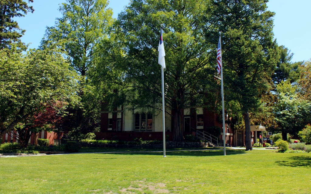
Today, almost nothing survives from the top photo, but this scene has still managed to retain much of its original scale, even if the buildings themselves are different. St. Mary’s Church still stands at the corner nearly a century after it was built, and next to it is the house that George Estabrook built around 1909. This house was sold to the church in the 1930s, and it now serves as the rectory. However, perhaps the only identifiable thing that survives from the top photo is the maple tree in the foreground on the right side of both photos. It is probably around 150 years old now, and it still stands here in the front yard of the Josiah Cooley House.