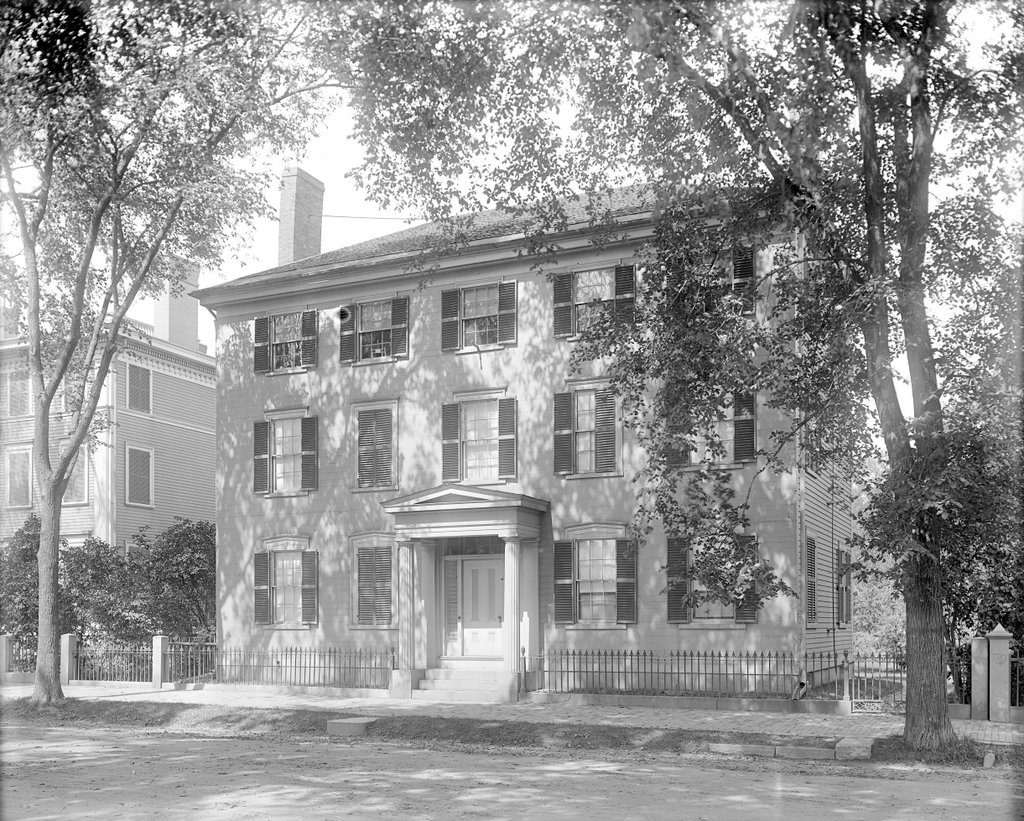
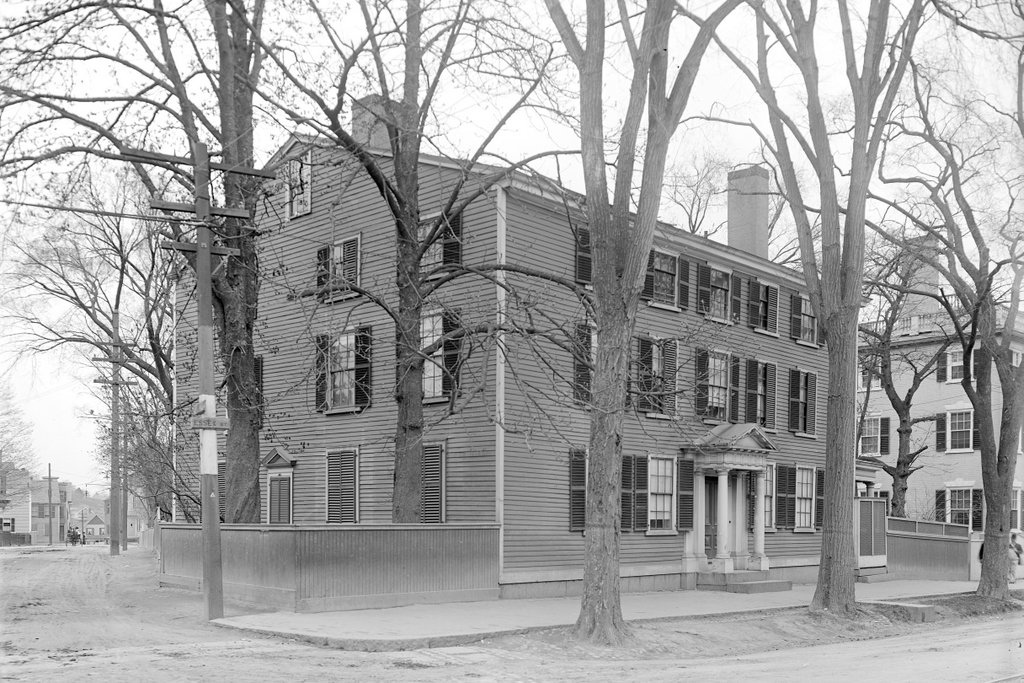
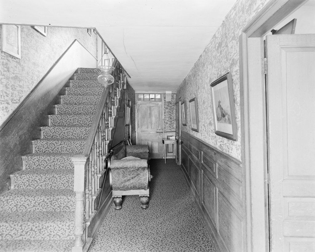
The main staircase at the Old Manse in Concord, probably around 1890-1910. Image courtesy of the Phillips Library at the Peabody Essex Museum, Frank Cousins Glass Plate Negatives Collection.
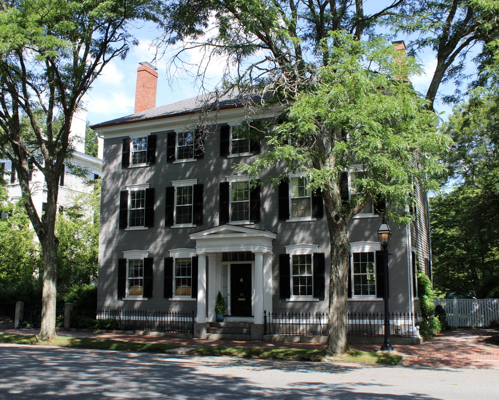
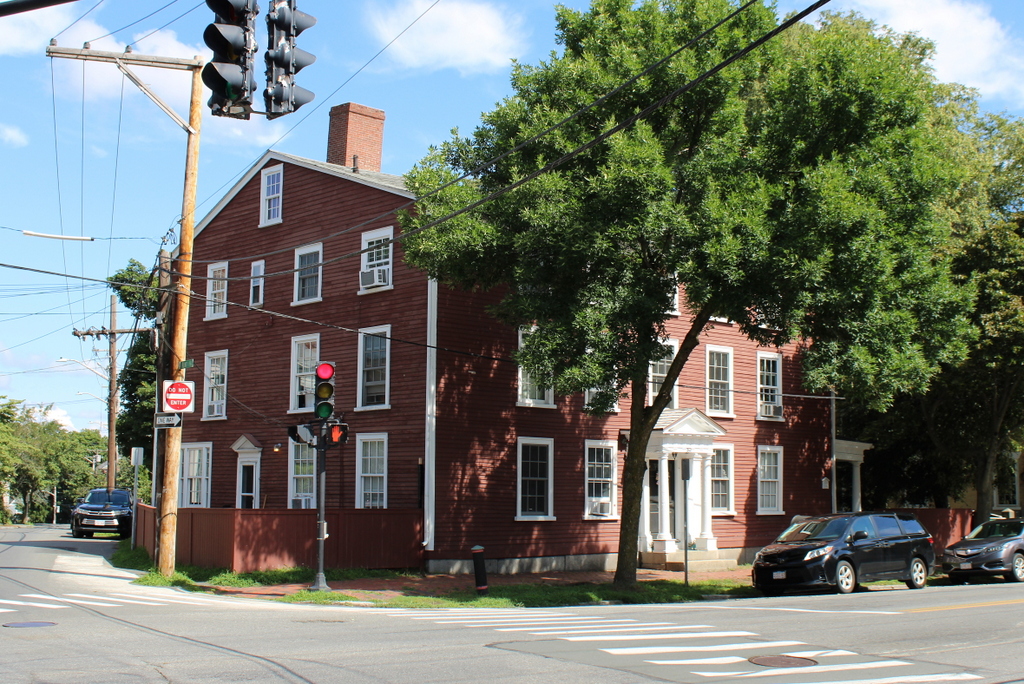
The scene in 2023:
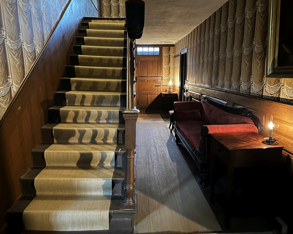
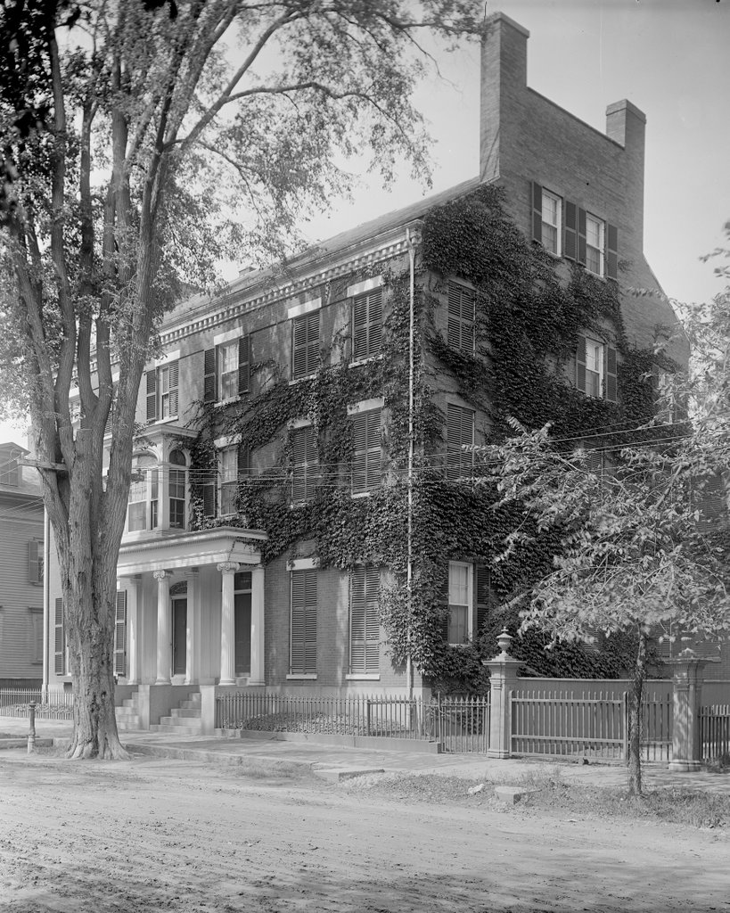
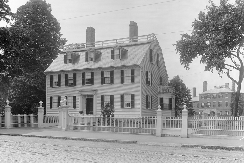
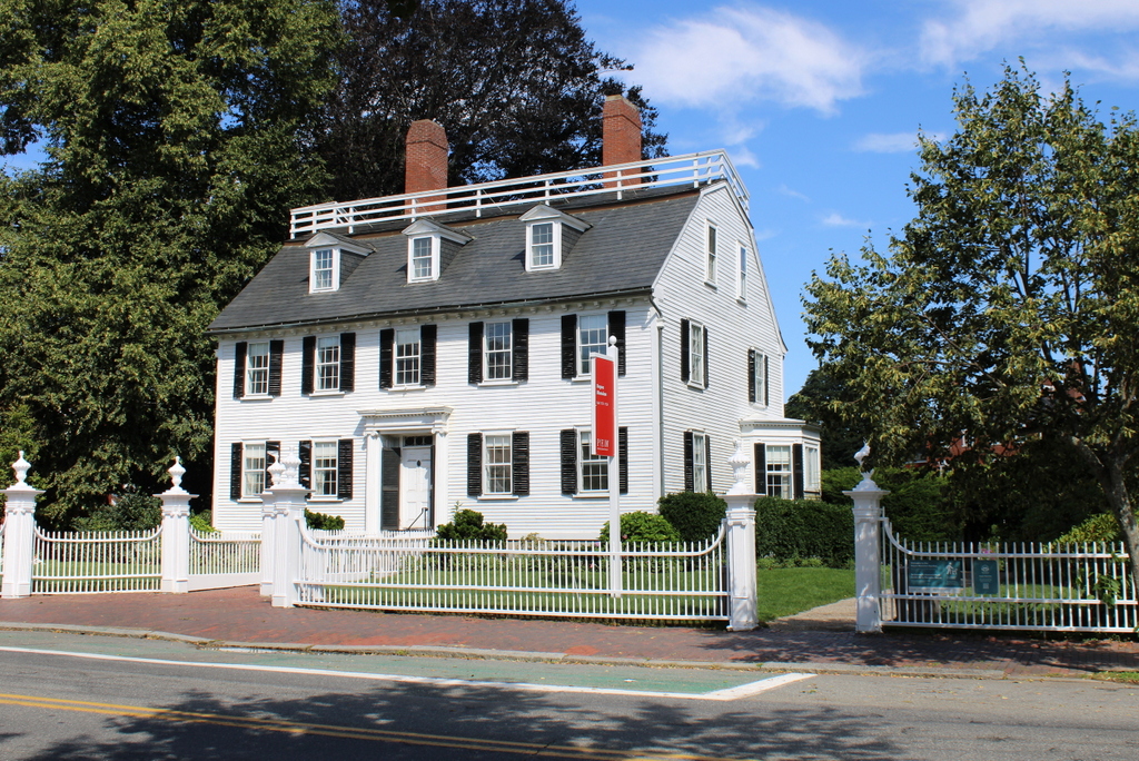
These two photos show the view looking up the main staircase from the front door at the Old Manse in Concord. This house, which was featured in more detail in an earlier post, was built in 1770 as the home of William and Phebe Emerson. William was the pastor of the church in Concord, but he died in 1776 while serving as a chaplain in the Continental Army. His widow Phebe subsequently remarried his successor, the Reverend Ezra Ripley, and the house would remain in their family well into the 20th century.
During this time, the house had several notable residents. William Emerson’s grandson was the prominent Transcendentalist writer Ralph Waldo Emerson, and he lived here for about a year from 1834 to 1835. He was not yet a famous author at this point, but he wrote one of his early works, the essay “Nature,” here in this house, in his study at the top of the stairs on the right side of the hall.
Ezra Ripley died in 1841, and his son Samuel inherited the house. However, he did not immediately move in, and instead rented the house to Nathaniel Hawthorne and his newlywed wife Sophia. They spent their wedding night here on July 9, 1842, and they lived here for the next three years. Like Emerson before him, Hawthorne was an aspiring yet largely unknown writer. He also used the same upstairs room for his study, and he wrote a number of short stories there, which would later be published in 1846 as the book Mosses from an Old Manse. However, Hawthorne struggled financially during this time and was unable to pay rent for the house, so he and his family ultimately moved out in 1845.
Another prominent resident here was Sarah Bradford Ripley, wife of Samuel Ripley. She and her husband moved into the house after the Hawthornes left in 1845, but Samuel died just two years later. Sarah was a self-taught scholar and educator, and after her husband’s death she earned an income by tutoring Harvard students here at the house.
Sarah Ripley died in 1867, but the house remained in her family for several more generations. The top photo was taken sometime around the turn of the 20th century, during the ownership of Sarah’s daughter Sophia Thayer. By this point the house was already a famous landmark, largely because of its association with Emerson and Hawthorne, and it had become known as the “Old Manse” because of the title of Hawthorne’s book that he wrote here.
In 1914, Sophia Thayer’s daughter Sarah Ames inherited the house. Sarah was the great granddaughter of Ezra and Phebe Ripley, making her the fourth consecutive generation to own the property. She died in 1939, and her husband subsequently donated the house, including all of its contents, to the Trustees of Reservations, a nonprofit conservation and historic preservation organization.
Today, the house still looks largely the same as it did when the Ripley family and their descendants lived here. The wallpaper here in the stairway hall has changed since the top photo was taken, in order to reflect the style of wallpaper that was here earlier in the 19th century. Otherwise, though, not much is different from the top photo, and even the sofa appears to be the same in both photos. The house is still owned by the Trustees, and it is open to the public for guided tours.