Milk Street, Boston (2)

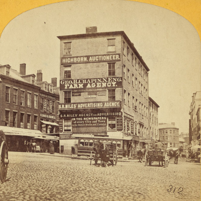
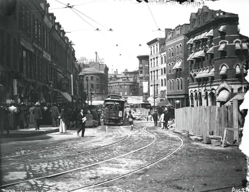
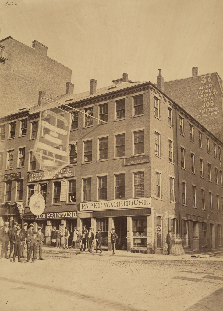
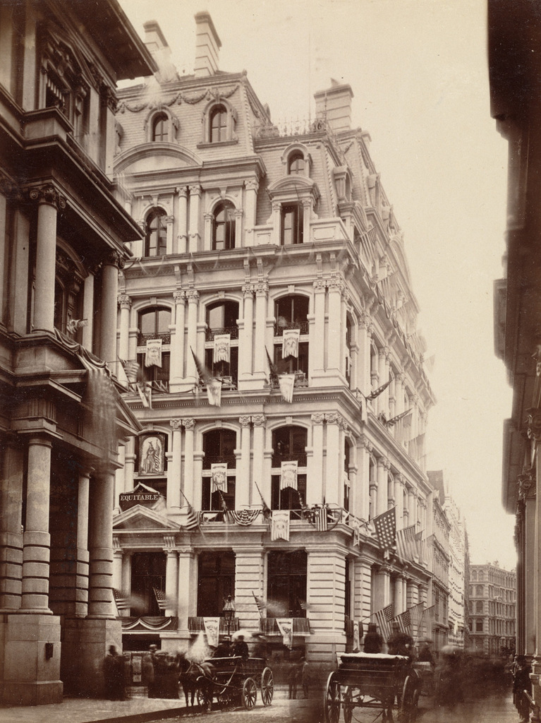
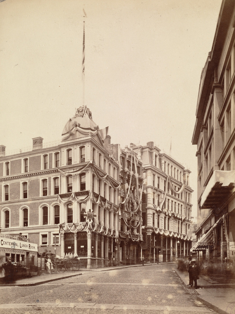
Looking west up Milk Street from Devonshire Street in Boston, on June 17, 1875. Image courtesy of the Boston Public Library.

819_1875-06-17 bpl

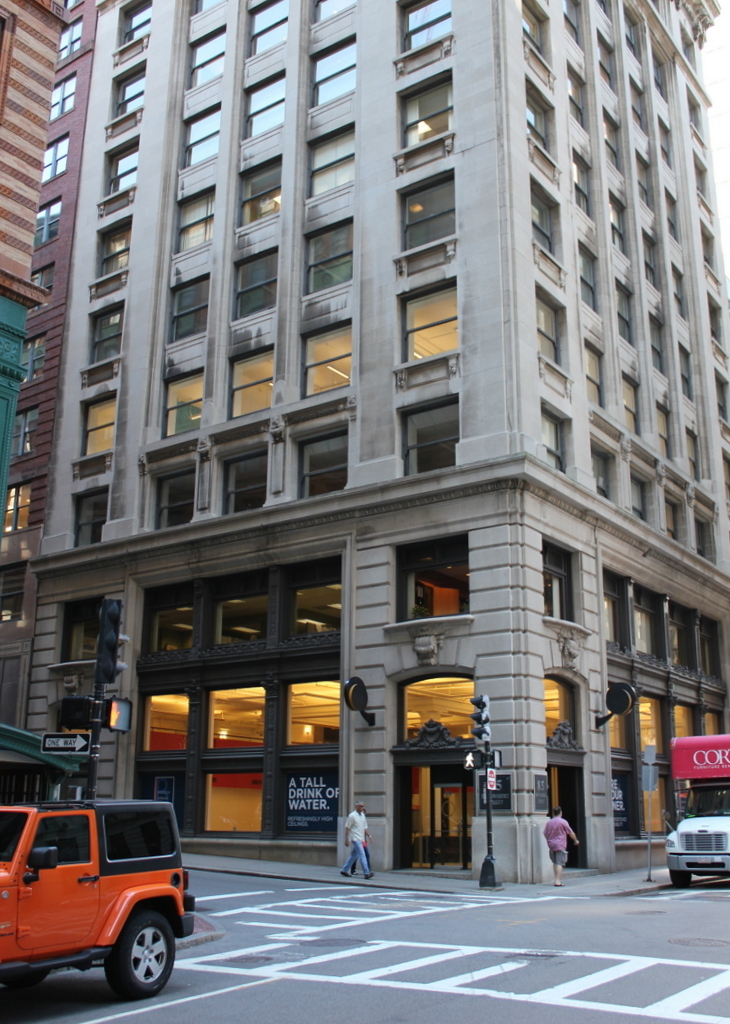
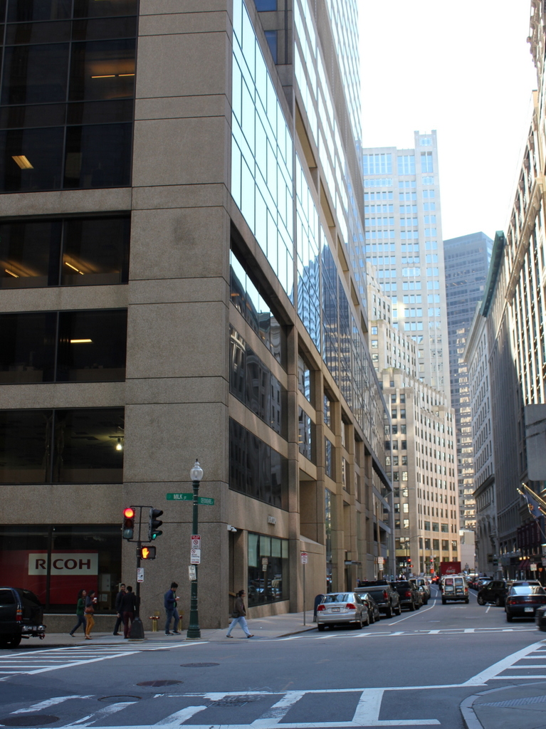
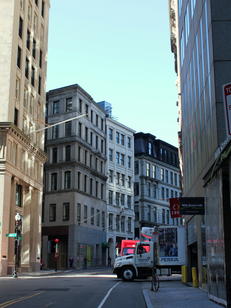
Milk Street in 2015:

819_2015
When the first photo was taken, the city was celebrating the 100th anniversary of the Battle of Bunker Hill, and these buildings on Milk Street were covered in patriotic bunting. All three of the buildings in the center of the photo were new; just three years earlier the area had been destroyed in the Great Boston Fire of 1872, as seen in the view looking down Milk Street in this post. However, the city soon rebuilt, and this area quickly became a major commercial center again.

All three of these buildings survive today, although with some alterations. The one on the left, at the corner of Milk and Hawkey Streets, is the Goddard Building. It was completed in 1873, and over the years it has been expanded, with two additional stories on top. The building to the right of it has also grown over the years. It was built on the site of Benjamin Franklin’s birthplace, and the decorative facade includes a bust of Franklin above the second story windows. The third building in the photo, on the right, was also built in 1873, at the corner of Milk and Washington Streets. It was originally the home of the Boston Transcript newspaper, which at the time was the largest circulating daily newspaper in New England. The newspaper has been defunct since 1941, but the historic building is still standing today.

Franklin Street, Boston (3)

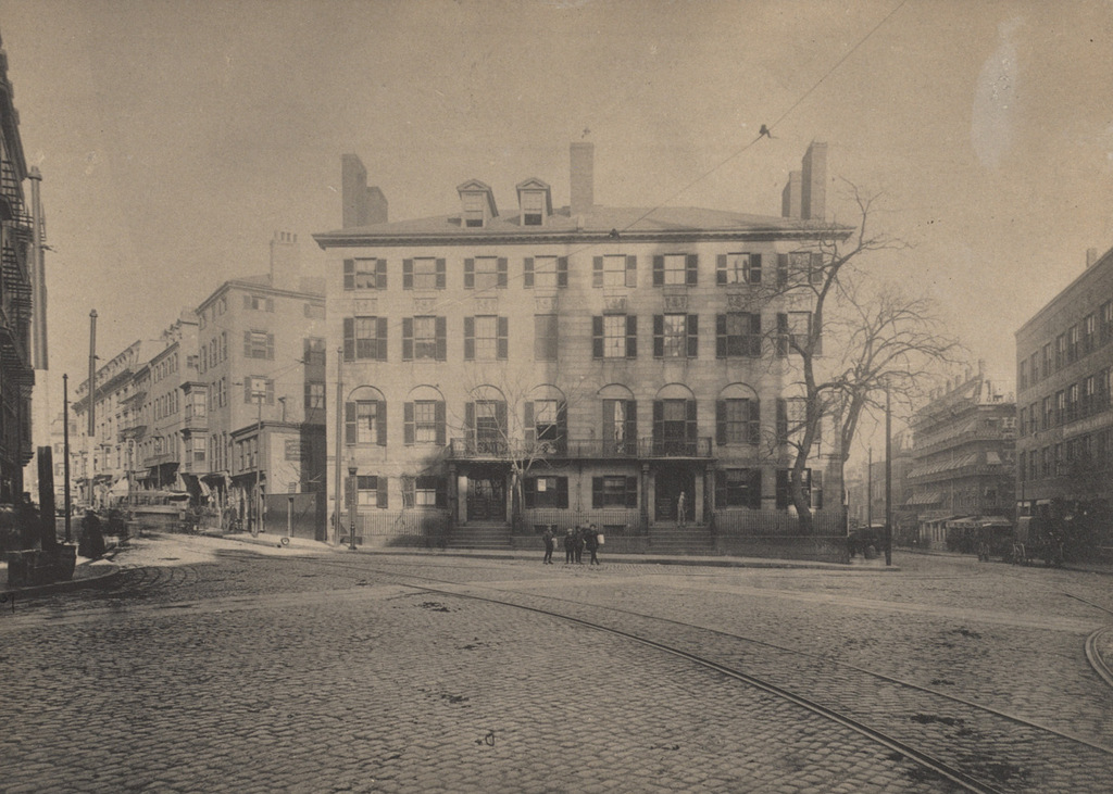
Looking west on Franklin Street from Devonshire Street in Boston, sometime in the late 1850s. Image courtesy of the Boston Public Library.

818_1857c bpl

Franklin Street in 2015:

818_2015
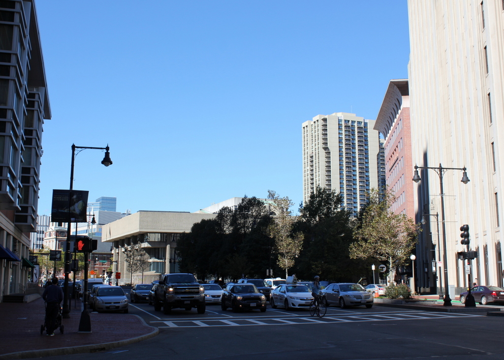
This view of Franklin Street shows the former Tontine Crescent section of the street from the opposite direction of the photos in these posts here and here. When this area was developed by architect Charles Bulfinch in the 1790s, it was an upscale residential neighborhood. Just a few years before the first photo was taken, this curve was lined with elegant townhouses, but by the late 1850s nothing remained of Bulfinch’s design except for a few trees in the middle of the street and the curve of the street itself.

The new commercial buildings in the first photo represented Boston’s growth and development as a prominent city, but they would turn out to be short-lived. Just over a decade later, the entire area was destroyed in the Great Boston Fire of 1872. They were rebuilt within the next year or so with similar-looking buildings, and many are still standing today. The 2015 photo shows a number of these 1870s buildings, although the background is dominated by Boston’s newest skyscraper, the Millennium Tower, which was under construction in the first photo and is scheduled to be completed in the summer of 2016.

Boylston Market, Boston

Boylston Market, at the corner of Boylston and Washington Streets in Boston, around 1870. Image courtesy of the Boston Public Library.

816_1870c bpl

The scene in 2015:

816_2015
Boylston Market was built here in 1810, and it was designed by noted architect Charles Bulfinch. It functioned as a market on the first floor, and a meeting space and performance hall on the third floor, known as Boylston Hall. Both the building and the street were named for Ward Nicholas Boylston, a Boston philanthropist who gave substantial donations to Harvard in the early 19th century. Prior to its construction, the city’s primary marketplace was Faneuil Hall, which was a considerable distance away from here. At the time, this area was in the southern end of the city, and some of its residents, including future president John Quincy Adams, formed the Boylston Market Association to built the market here

Aside from its use as a marketplace, the building was also used by organizations such as the Handel and Hadyn Society, which held concerts in the third floor hall, and the New England Anti-Slavery Society, which held conventions in the same hall. In 1859, it was expanded, and in 1870 it was moved 11 feet south away from Boylston Street. This is presumably why the building to the left in the first photo, home of the White Bear Billiard Room, has a sign that reads “Building to be Torn Down.”

Although moving the large brick building was a significant undertaking, Boylston Market was demolished just 17 years later, in 1887. It was replaced by the Boylston Building, which served much the same function as its predecessor, with retail space on the first floor and warehouse and office space on the upper floors. As seen in the 2015 photo, it is still standing today, and it is listed on the National Register of Historic Places. There is at least one surviving element from the original building, though. The cupola was saved, and it now forms the steeple of the Calvary Methodist Church in the nearby town of Arlington.

Boston and Providence Depot, Boston

The Boston and Providence Depot at Park Square in Boston, around 1860. Image courtesy of the Boston Public Library.

815_1860c bpl

The station around 1885. Image courtesy of the Boston Public Library.

815_1885c bpl

The scene in 2015:

815_2015

The Boston and Providence Railroad opened in 1835, at a time when Boston was still a peninsula connected to the mainland by a narrow isthmus. To avoid taking up scarce land, the railroad built a long trestle across the Back Bay, which at the time was a tidal marsh between Boston and Roxbury. The railroad terminal was built here at the edge of the water, at what eventually became Park Square.

The original station from the first photograph was demolished in the early 1870s so that the city could build Columbus Avenue, and it was replaced with the much larger station in the second photograph. In advertisements, it was hailed as “The Palace Depot of the World,” and from here passengers could board a train for Providence, New York, and other points south. However, by the late 19th century there were eight different railroads serving Boston, each of which operated its own separate station. The four railroads on the north side all had terminals near where North Station would be be built in 1893, and three of the south side terminals were located in the immediate vicinity of today’s South Station. The Providence and Worcester depot was the one outlier; it was on the south side, but it was a half mile away from the next closest station.

Because the multiple stations were both inconvenient for passengers and a waste of valuable property, the four south side railroads finally consolidated into South Station in 1899. This station and the tracks leading to it were closed, and the railroad, which by then had been leased to the New York, New Haven and Hartford, was rerouted onto new tracks, parallel to the Boston & Albany Railroad.

Today, none of the buildings from the first two photos are still standing. The site of the station is now the Boston Park Plaza Hotel, which was built in 1927 as the Hotel Statler Boston in the triangular block between Columbus Avenue, Park Plaza, and Arlington Street. The only visible remnant from the first photo is the Emancipation Memorial statue, which was added to Park Square in 1879 and can be seen on the far left of both photos.


Charles Street Meeting House, Boston (2)

Looking north on Charles Street toward the Charles Street Meeting House in Boston, around 1889. Image courtesy of the Boston Public Library.

814_1889c bpl

The scene in 2015:

814_2015
As mentioned in the previous post, this historic church was built in 1807 as the Third Baptist Church. It played a major role in the abolitionist movement in Boston, and it was later the home to the Charles Street African Methodist Episcopal Church from 1876 until 1939. It was converted into offices in the early 1980s, but from the exterior it looks essentially the same as it did over 125 years ago. It is one of the 15 landmarks that comprises the Boston African American National Historic Site on Beacon Hill.  The buildings beyond it on Charles Street haven’t changed much, either. They date back to the second half of the 19th century, and like so many other buildings in the Beacon Hill neighborhood, they have been well-preserved over the years.

Beacon Street from Arlington Street, Boston

Looking west on Beacon Street from the corner of Arlington Street, in 1870. Image courtesy of the Boston Public Library.

812_1870 bpl

Beacon Street in 2015:

812_2015

The houses on the right side of this scene are the oldest buildings in the Back Bay, dating back even before the large-scale landfill project had begun. The origins of Beacon Street date back to 1818, when construction began on a dam across the Back Bay, which at the time was a tidal marsh connected to the Charles River. The dam used the power of the tides to operate factories nearby, but it also had an added benefit of serving as a second route in and out of Boston, by extending Beacon Street across it.

The dam, which was completed in 1821, turned out to be a failure, and by the 1850s there were plans in the works to fill the Back Bay and expand Boston’s land area. The houses here on the right side of the street were built around 1856 on land that had already been filled; they can be seen in the distance in the first photo in this post, which was taken from the top of the State House in 1857. By the time the 1870 photo above was taken just 13 years later, the landfill project was well underway, and both sides of Beacon Street had been developed as far as Dartmouth Street, three blocks in the distance.

Nearly 150 years after the first photo was taken, many of the buildings from the first photo are still standing, including most of the 1850s houses to the right. The only major change in the foreground is the pair of houses on the far right, numbered 100-102 Beacon Street. Half of the building was demolished in 1924 to build the apartment building that stands there today. The other half at 102 Beacon is still standing, although it was altered beyond recognition in 1938, when it was converted into an 18-unit apartment building with a new facade. However, the next seven houses in a row, numbered 104-116 Beacon Street, also date back to around 1856. They are all virtually identical, and 160 years later all seven are still standing, essentially unchanged on the exterior. The use of the buildings has changed, though; today, all seven, along with the neighboring properties at 102 and 118 Beacon Street, are owned by Fisher College and are used for classrooms and dormitories.

For more information on the history of these houses, see the Back Bay Houses website.