Main Street, Hartford Connecticut

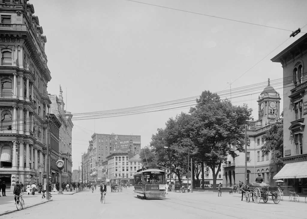
Looking north on Main Street in Hartford from near the corner of Pearl Street, around 1905. Image courtesy of the Library of Congress, Detroit Publishing Company Collection.

517_1905c loc (02 City Hall and Main Street)

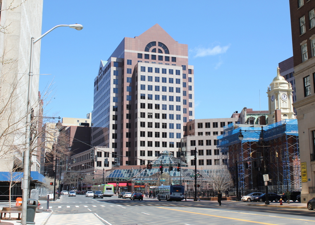
Main Street in 2015:

517_2015

Not much remains the same between these two views of Main Street in Hartford, although one of the few surviving buildings also happens to have been probably the oldest from the 1905 photo – the Old State House, on the right-hand side.  Built in 1796, it was substantially older than all of the other buildings in the foreground in 1905, but today it is double the age that it was back then, and all of its neighbors have long since been replaced by modern skyscrapers.  The only other survivors from 1905 are a couple buildings in the distance.  One of these is the tall building the left-center of the 1905 scene.  At the time, it towered over the other buildings on Main Street, but today it is literally in the shadows of its neighbors, and is barely noticeable in the 2015 scene.

Aside from the changes in buildings, the two scenes also show the differences in transportation.  The trolleys of 1905 have been replaced by buses, bicycles are not nearly as common on Main Street today as they were 110 years ago, and there are far fewer pedestrians walking along the street (although granted the 2015 photo was taken on a Saturday – a weekday scene would probably look busier).  Also in the first photo is a large billboard just to the left of the center, with the words “Wilson High Ball that’s all!”  Wilson was a blended whiskey brand, and in between the two photos alcohol went from being legal, to being illegal, and then back to being legal again.  The company apparently survived Prohibition, but like the building that once featured its billboard, it doesn’t appear to be around anymore.

Connecticut State Capitol, Hartford

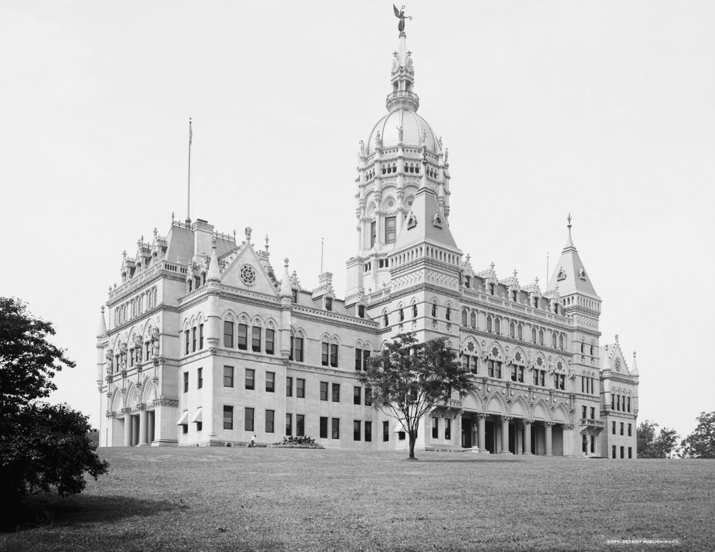
The Connecticut State Capitol in Hartford, seen from Bushnell Park around 1906. Image courtesy of the Library of Congress, Detroit Publishing Company Collection.

511_1906c loc

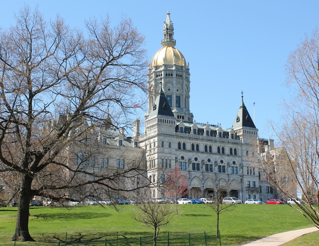
The capitol in 2015:

511_2015

For many years, Connecticut had a rather unusual capital city arrangement. Despite being geographically one of the smallest states, they had two capital cities: Hartford and New Haven. The General Assembly alternated locations, thus accommodating both the section of the state along the coastline, as well as those who lived further inland.  The state even had two different state houses, with one in each city. This was presumably beneficial for travel when the system was established in 1701, but by the second half of the 19th century railroads made the 35 miles between the two cities far more manageable. It was impractical to continue to have two different capitals (not to mention two different capitols), so in 1875 Hartford became the sole capital city.

To commemorate the unification of the capitals, Connecticut built a new state capitol at the southern end of Bushnell Park, and it has been the seat of Connecticut government ever since.  The only readily apparent change between the two photos is the statue on top of the dome. Called The Genius of Connecticut, it was damaged in the 1938 Hurricane and taken down; several years later it was melted down as scrap metal for the war effort. In front of the building, Bushnell Park is still there, albeit with more trees and substantially more parking spaces than in the 1906 scene.

Old Church and Courthouse, Northampton, Mass

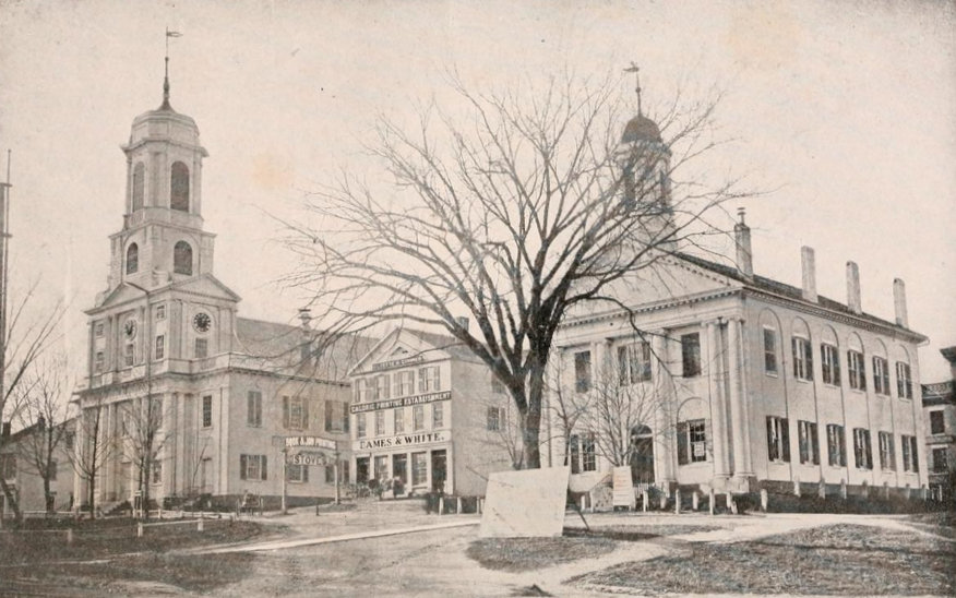
Looking up Main Street from Pleasant Street in Northampton, toward the old church and courthouse in 1864. Photo from Reminiscences of Old Northampton (1902).

508_1864 reminiscencesofoldnorthampton

The location in 2018:

The 1864 photo is one of the oldest existing photographs of downtown Northampton, and none of the buildings from that scene survive today, 151 years later.  To the left in the 1864 photo is the old church, which was built in 1812.  It was Northampton’s fourth meeting house, and it replaced the 1737 building that had been built during the pastorate of Jonathan Edwards.  It was from here that the influential pastor and theologian helped to spark the Great Awakening revival that spread across the American colonies and in Europe, but by the turn of the century the town was in need of a new building.  The 1812 church was designed by Northampton architect Isaac Damon, who just a few years later would design Old First Church in Springfield, 15 miles to the south.  However, while Old First Church survives to this day, the Northampton church seen in the 1864 photo burned in 1876, and was replaced two years later by the current brownstone church.

On the far right of the 1864 photo is the old Hampshire County Courthouse.  I don’t know when it was built, but it is virtually identical to the 1821 Hampden County Courthouse, seen on the far left of the 1882 photo in this post.  Because of its similar appearance, the Hampshire County Courthouse was probably built around the same time, shortly after some major changes to the county’s borders.  Originally, Hampshire County included all of Western Massachusetts, but it was steadily broken up into multiple counties, beginning in 1761 when Berkshire County was established to the west.  Then in 1811, Franklin County was created in the northern part of the Connecticut River Valley with Greenfield as the county seat, and a year later Hampden County split off to the south, with Springfield as the county seat.  I don’t know what happened to the old courthouse seen here, but it was gone by 1886, when the present-day Hampshire County Courthouse opened on roughly the same spot at the corner of Main and King Streets.

In between the two prominent buildings in the 1864 scene is a relatively small commercial block, the Whitney Building.  The photograph was actually commissioned by George D. Eames, the owner of the building, and was probably intended to advertise the building’s prominent location in town.  Part of the building housed the offices of the Hampshire Gazette, and the newspaper was published in the basement.  This is evidently the reason for the large sign on the building that reads “Caloric Printing Establishment.”  The Whitney Building was demolished in 1876, and a bank building was put in its place.  Today, the 1916 Northampton Institute for Savings building occupies the site where the Whitney Building once stood.

City Hall, Holyoke Mass

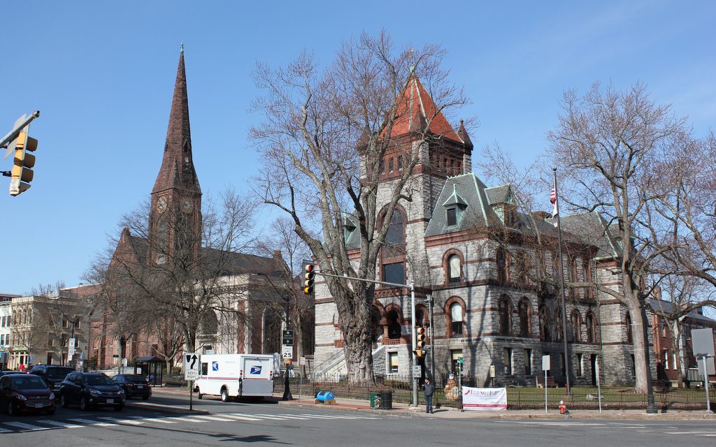
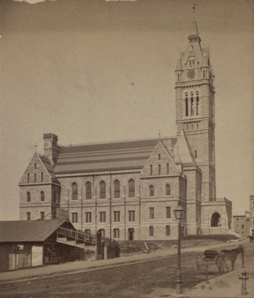
City Hall in Holyoke, seen looking up Dwight Street in 1892. Image courtesy of the New York Public Library.

494_1892 nypl

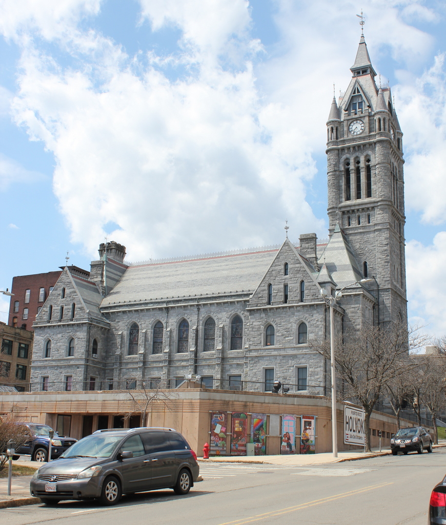
City Hall in 2015:

494_2015

It almost resembles a Medieval cathedral, and in fact the original caption of the 1892 photo misidentified it as a church, but this building is actually Holyoke City Hall.  Opened in 1876, it bears some resemblance to the Hampden County Courthouse.  Both were made out of the same material, granite from Monson, Massachusetts, and with similar neo-Gothic and Romanesque style architecture, which was common in late 19th century public buildings.  Curiously, it had two architects: Charles B. Atwood, who designed most of the exterior, and Henry F. Kilburn, who took over after Atwood failed to produce his work in a timely manner.  Kilburn ended up designing the interior and the 220 foot tower.  Today, the exterior is well-preserved; it continues to be used as City Hall, and it is listed on the National Register of Historic Places.

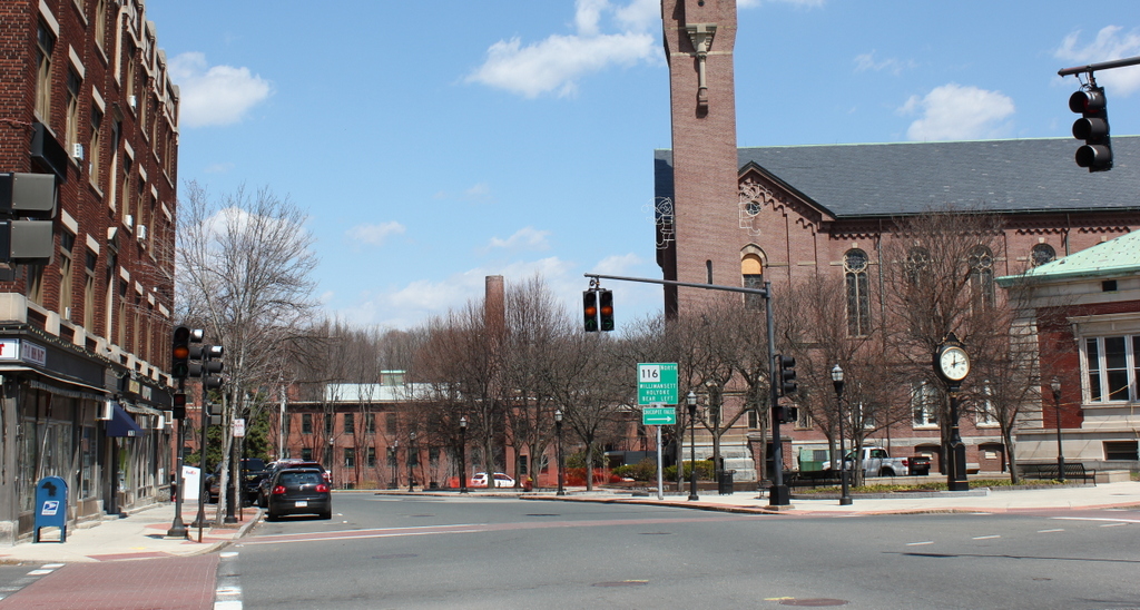
Center Street, Chicopee

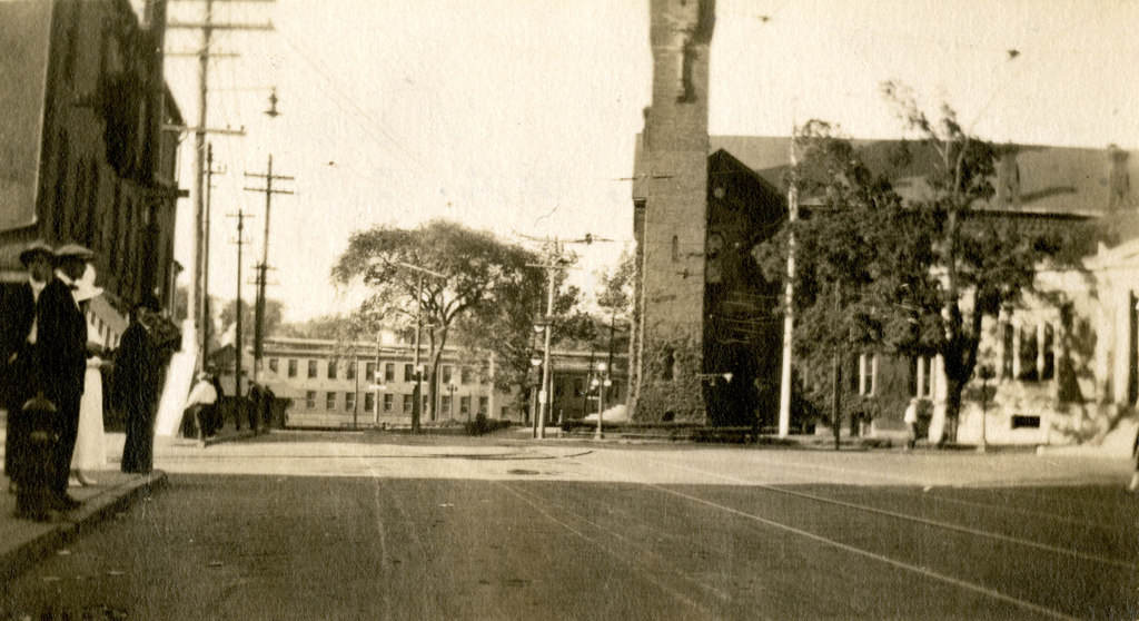
Center Street in Chicopee, probably in 1918. Image courtesy of the Chicopee Public Library, Russ H. Gilbert Photographic Collection.

490_1918c chicopeepubliclib

Center Street in 2015:

490_2015


One of the busiest sections of road in Chicopee is completely void of traffic in the 1918 scene, but it wasn’t necessarily because people lacked cars.  At this point, cars were becoming more common among the middle class, but this became a problem during World War I.  Because of the war demand for fuel, the federal government implemented programs to help reduce fuel use.  One of these plans was “gasless Sundays,” when people were encouraged to avoid driving on Sundays, thus saving a substantial amount of gasoline.  I don’t know how effective it was overall, but evidently it worked in Chicopee – the first photo was taken during one of these “gasless Sundays,” and sidewalks are full of people, with nary a car in sight.

The only real change in these two views, other than the presence of automobiles, is the building on the far left.  This building at the corner of Center and Exchange Streets was replaced by the Starzyk Building in 1921.  Otherwise, the other buildings are still there: the Spalding factory in the distance, the 1871 Chicopee City Hall to the right, and the old 1911 Chicopee Public Library building.

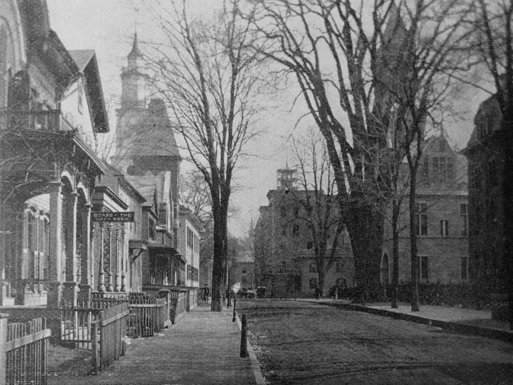
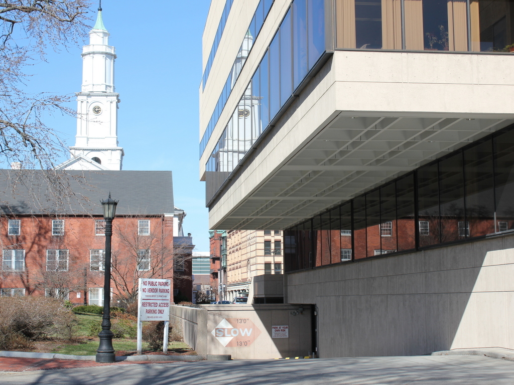
Elm Street, Springfield Mass

Looking east on Elm Street in Springfield, around 1892. Photo from Picturesque Hampden (1892).

487_1892c picturesquehampden

Elm Street in 2015:

487_2015

Elm Street still appears on city maps, although today it isn’t much of a street.  While it used to extend from Main Street to the Connecticut River, today it is a pedestrian walkway and parking lot for courthouse employees that dead-ends in front of the Hampden County Courthouse.  This area has gone through several major changes, the first of which came soon after the first photo was taken.  In the first decade of the 1900s, all of the buildings between Elm Street and Court Street were demolished in order to extend Court Square down to the river; only Old First Church was spared.  Later on, Columbus Avenue was built across this area, and in the 1970s the Hampden County Hall of Justice was built, with part of the building’s footprint covering what used to be Elm Street.

Despite all of the changes, several important buildings have survived from the first photo.  On the left, the steeple of Old First Church is still there, although the brick addition behind it was extensively modified in the 1940s.  To the right, the old Hampden County Courthouse is still there, although it isn’t visible from this angle.  Beyond it, the Court Square Theater was under construction in the first photo, and was added on to in 1900.  It can still be seen in the distance, along with the adjacent Byers Block and Chicopee Bank Building, which existed in the first photo although they aren’t really visible.  One prominent landmark, however, that has not survived is the massive elm tree on the right side of the street.  It was located in front of the Elm Street Grammar School (barely visible on the far right), and is believed to be the tree referred to by Oliver Wendell Holmes in The Autocrat of the Breakfast Table.  Referring to notable elm trees that he has seen, he writes that,The queen of them all is that glorious tree near one of the churches in Springfield. Beautiful and stately she is beyond all praise.”  When the tree was finally cut down, a cross-section of it was saved and is now on display at the Springfield Science Museum.