Calvin Coolidge at Plymouth, Vermont (2)

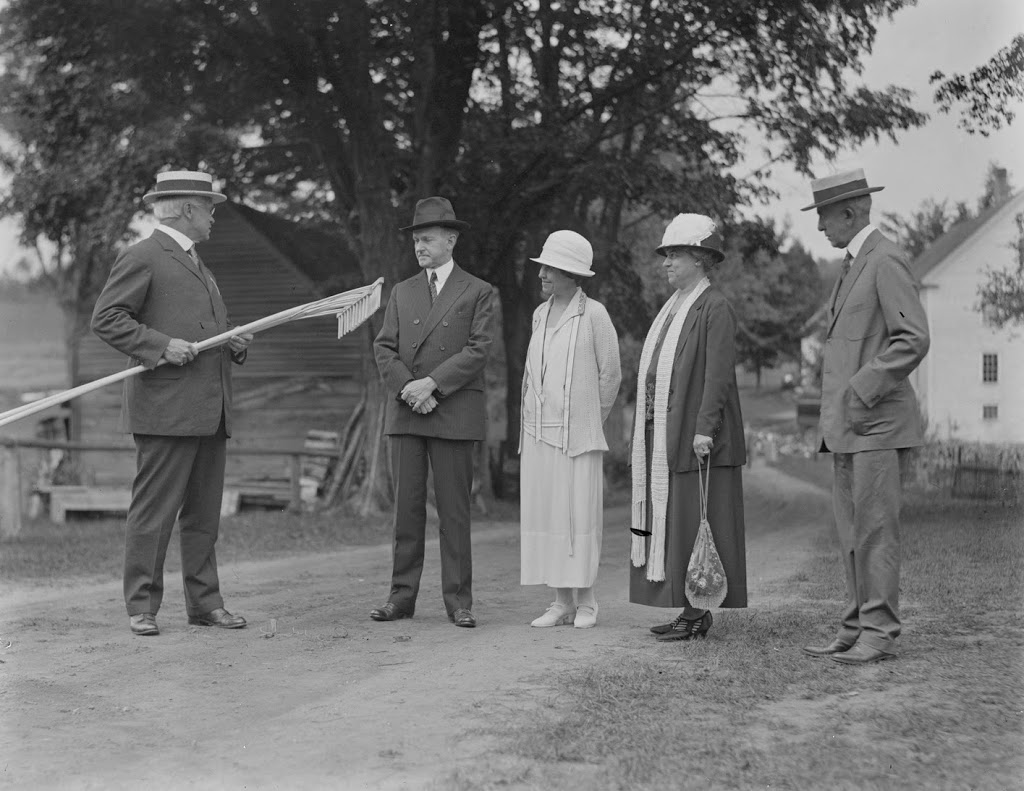
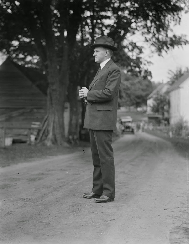
President Calvin Coolidge in the road in front of his family’s house in Plymouth, Vermont, in August 1924. Photo courtesy of Boston Public Library, Leslie Jones Collection.

424_1924-08-2Bbpl

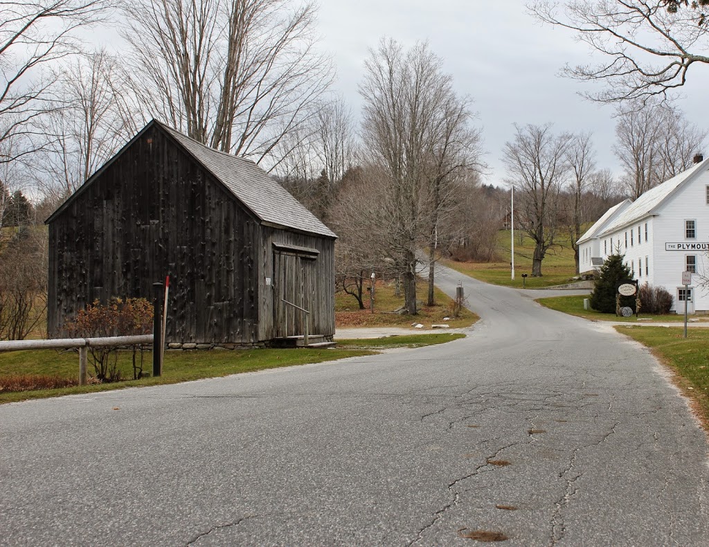
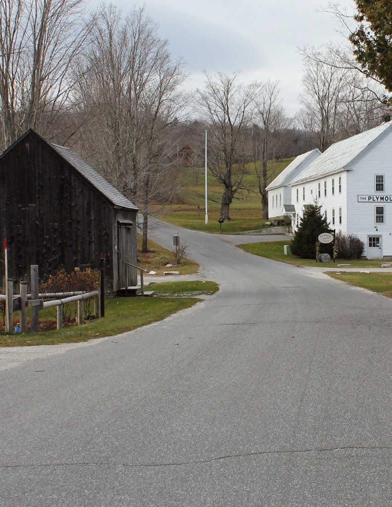
The road in 2014:

424_2014

From this spot, President Coolidge would have been looking at the Union Christian Church, which is across the street from the house that he grew up in.  He is standing on Messer Hill Road, and the building beyond him and to the left is a c.1870s shed that served as the workshop for his father’s farm.  On the right-hand side is the Plymouth Cheese Factory, which was opened by Coolidge’s father and four other local farmers in 1890.  It was later owned by Coolidge’s son John, and today it is owned by the Vermont Division for Historic Preservation and still operates as a cheese factory.

I don’t know why Coolidge was standing in the middle of the road, but apparently neither did photographer, Leslie Jones of the Boston Herald-Traveler.  His caption was “A penny for his thoughts,” although it probably would have taken more than a cent to get Silent Cal talking.  Certainly, though, his thoughts could’ve been on his on, Calvin Coolidge, Jr., who had died just a month earlier of blood poisoning following an infected blister.  Perhaps this was the reason for the vacation to Plymouth – an opportunity to get away from D.C. and spend time with his father, his wife, and their other son John.

Plymouth, Vermont

The village of Plymouth, Vermont, in August, 1924. Photo courtesy of Boston Public Library, Leslie Jones Collection.

427_1924-08-2Bbpl

Plymouth in 2014:

427_2014

The first photo was taken when President Calvin Coolidge vacationed in his hometown of Plymouth, Vermont.  The first scene shows many visitors, most of whom were probably there hoping to catch a glimpse of Coolidge.  After all, this was part of his image as president; that he was a humble, down-to-earth New England farmer and a friend of the common man.  Certainly the setting did little to detract from this image; most of the “center” of Plymouth can be seen in this view, with the general store/post office in the foreground, the church visible behind it, and the Coolidge Homestead to the right.

All of these buildings are part of the Calvin Coolidge Homestead District, and each one has some significance to the president.  He lived in the house to the right from age four until he left for high school, he and his family attended the church across the street, and he was born in the back of the post office/general store.  This building was built in the 1850s, and Coolidge’s father owned it from the 1870s until 1917.  During his 1924 visit, Coolidge used the upper room in the store as his “Summer White House.”

Bellows Falls, Vermont

The Square at Bellows Falls, Vermont, around 1907. Image courtesy of the Library of Congress, Detroit Publishing Company Collection.

The scene in 2018:

The village of Bellows Falls is probably best known to baseball fans as the birthplace of Hall of Fame catcher Carlton Fisk, but historically it has been a significant settlement along the Connecticut River.  As the name implies, it is located at a waterfall on the Connecticut River, where the river passes through a narrow gorge.

The waterfall benefitted the village in several ways; first, the narrow width of the river made it easy to bridge.  In fact, the first bridge across the Connecticut River was built here in 1785, which made this a major transportation center, originally for stagecoaches and later for trains; it became a major railroad hub in the 19th century.  The falls also attracted many industries to Bellows Falls, and in the 19th century many industries developed along the river, powered by a canal that took advantage of the river’s 52-foot drop in elevation.

This scene shows the center of the village, much of which has changed in the past 108 years.  It retains its small-town appearance, but most of the buildings in the first photo have since been destroyed in a succession of fires, the first of which occurred in 1912 and destroyed several of the buildings on the right-hand side.  The two buildings just beyond the gabled brick building on the right date to the 1800s, but only the shells of the buildings survived the fire.  Closer to the camera on the right is the Hotel Windham, which was built in 1933 to replace the previous building, which burned in 1932.  On the left, the old post office and library, with its distinctive tower, burned in 1925, and was replaced with the present building the following year.

The only two surviving buildings on the square that are visible in both photos are the 1875 Centennial Block on the far left-hand side, which was itself damaged by a fire in 1978, and the wood commercial block in the distant center of both photos, which dates to around 1890 and is probably the only building in the 1907 photo that never had a fire.

Westminster Street, Bellows Falls, Vermont

Looking south on Westminster Street in Bellows Falls, Vermont, around 1907. Image courtesy of the Library of Congress, Detroit Publishing Company Collection.

416_1907c-2Bloc

Westminster Street in 2014:

416_2014

Like many other towns and cities in New England, this main road in Bellows Falls was once lined with tall trees on both sides.  However, in the ensuing century, disease, hurricanes, and other factors resulted in a far less impressive streetscape.  Today, many of the houses are still there, but the street has been paved, the guardrail on the left-hand side has been replaced with something a little more substantial, and parking spaces have replaced hitching posts on the right-hand side of the road.

Union Block, Springfield, Mass

The corner of Main Street & Harrison Ave in Springfield, Mass, around 1878-1885.  Photo courtesy of New York Public Library.

412_1865-1885c-2Bnypl

The corner in 2017:


This view is very similar to the scene in this post, although the historic photo here is about 30 years older and shows just the buildings along Main Street from Harrison Ave to Court Street. As mentioned in the other post, the building in the foreground here is actually three buildings, which were constructed between 1858 and 1861, and came to be known as the Union Block.  The earliest section, furthest from the camera, is the Republican Block, and it was the home of the Springfield Republican newspaper from 1858 until 1867.  By the time the first photo was taken, it was the home of D.H. Bingham & Co. Clothing House, as seen on the massive sign atop the building.

The Republican Block is the only part of the Union Block that has survived relatively intact to this day.  The middle section, formerly home of Johnson’s Bookstore, is the original 1861 structure, but its facade was completely renovated in 1908 and does not retain any of its original architecture.

Closest to the camera, the northernmost third of the block was home of Kibbe Brothers Co., a large candy manufacturer in the city.  The Union Block was their home throughout the late 1800s, until they moved around the corner to a larger facility on Harrison Ave in 1890, which can be seen in this post.  This part of the Union Block was demolished in 1915, and replaced with the 10 story building that stands there today.

Main Street, Springfield, Mass

The view looking north on Main Street toward Elm Street and Court Square, around 1865-1875. Photo courtesy of New York Public Library.

1870s

The scene in 2017:

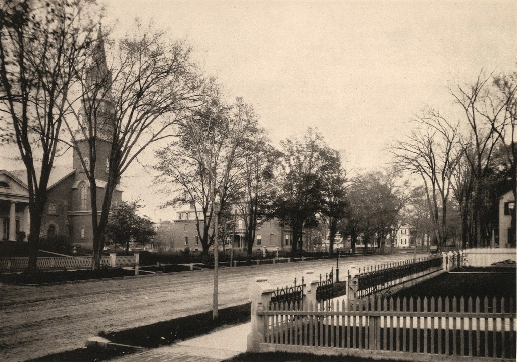
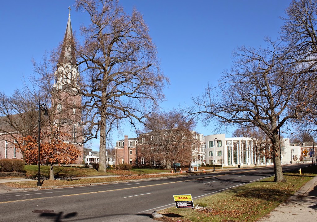
The first photo has to be one of the earliest photographic views that I’ve seen of Main Street in Springfield.  Most of the views of Main Street that I have featured on this blog show a busy urban scene with large commercial buildings.  That wasn’t the case in this photo, which was probably taken right after the end of the Civil War.  There is certainly commercial activity going on in the foreground, in the immediate vicinity of Court Square, but further up Main Street it has not yet been developed to the extent that later photographs show, such as this one taken a block north and about 50 years later.

Many of the commercial buildings in this scene, especially the ones on the far left and far right, show the Federal style architecture that was common for commercial buildings in Springfield during the first half of the 19th century.  Most of these would be demolished by the turn of the century and replaced with larger, more modern buildings, such as the 1889 Chicopee Bank Building on the left-hand side in the 2017 photo.  Today, as far as I can tell, the only surviving examples are Byers Block just around the corner on Elm Street, Guenther & Handel’s Block on Stockbridge Street, and the Gunn and Hubbard Blocks on State Street opposite the Armory.

Almost everything from the first photo is gone today, including several blocks on the right-hand side, where the MassMutual Center was built in the 1970s.  However, there are at least two buildings from the first photo that still exist, in the block visible in the distance just in front of the church steeple.  This block was made up of three buildings, two of which survive today: the former Johnson’s Bookstore building and the Republican Block.  It is also possible that the 1865 Haynes Hotel (seen in this post) appears in the first photo, although from this angle it is hard to tell.