Soldiers and Sailors Memorial Arch, Hartford Connecticut

The Soldiers and Sailors Memorial Arch on Trinity Street in Hartford, around 1900-1910.  Image courtesy of the Library of Congress, Detroit Publishing Company Collection.

513_1900-1910 loc

The arch in 2015:

513_2015

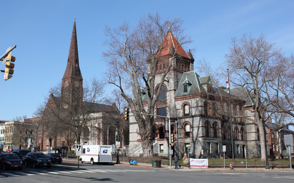
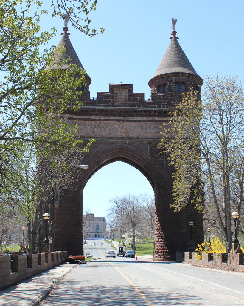
Many cities and towns across the country have some sort of Civil War monument with a statue on top, but Hartford took it one step further and designed a pair of medieval-style towers connected by an arch.  The monument honors the approximately 4,000 Hartford citizens who served in the war, about 400 of whom never returned home.  It was dedicated in 1886, and spans Trinity Street not far from the State Capitol, which is off to the right, beyond the right-hand tower.  At the time that the first photo was taken, the section of road in front of the tower was a bridge over the Park River.  The bridge is still there, but the river has since been put underground and the grade was raised on the old riverbed.  Trinity Street has also changed – there are no longer any trolley tracks running down the middle, and because of how narrow the arch is, the street has been reduced to a single lane of one-way traffic.

Corning Fountain, Hartford Connecticut

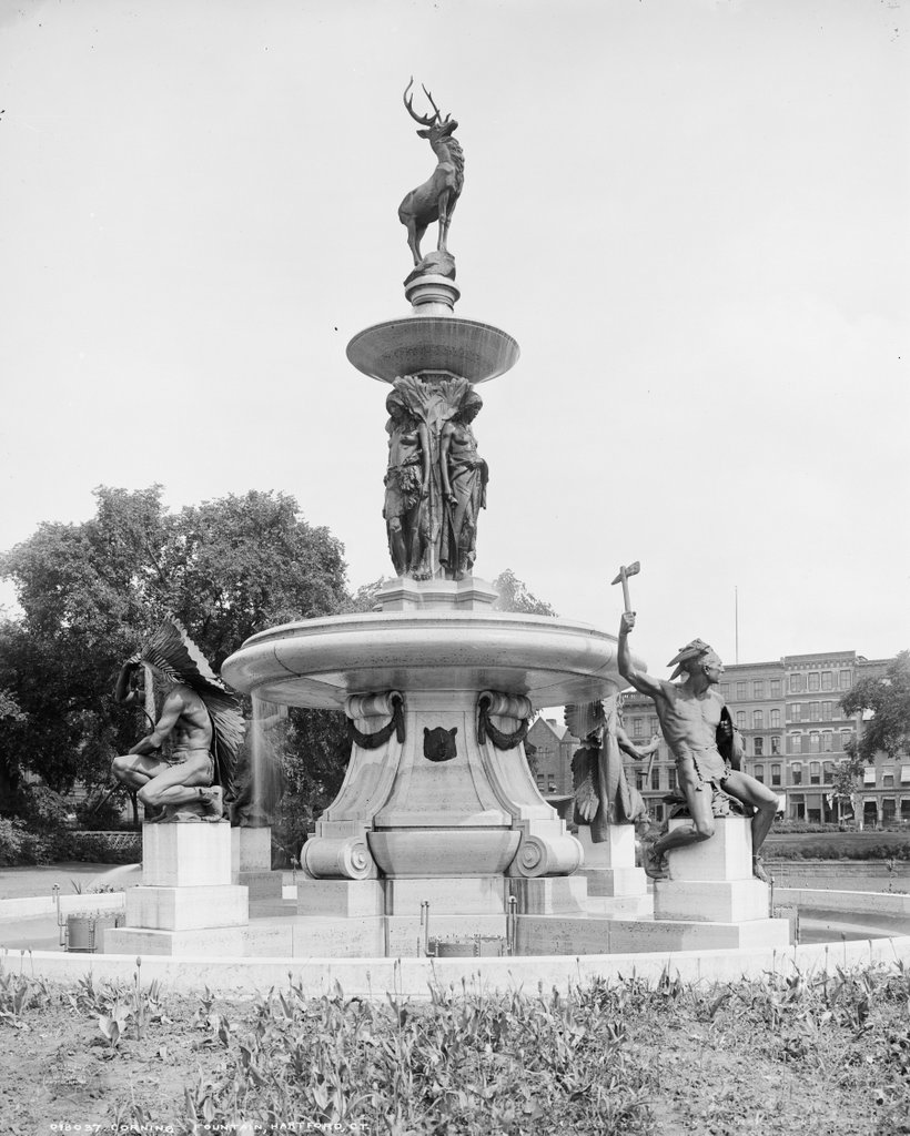
The Corning Fountain in Bushnell Park in Hartford, around 1905. Image courtesy of the Library of Congress, Detroit Publishing Company Collection.

512_1905c loc

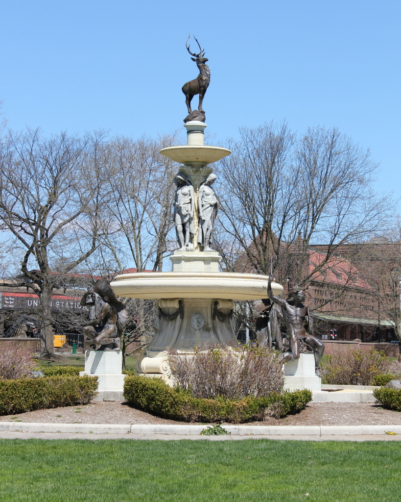
The fountain in 2015:

512_2015

The Corning Fountain was given as a gift to the city of Hartford in 1899 by John J. Corning.  It was designed by J. Massie Rhind, and features Native Americans representing local tribes, with a deer on top.  The city’s name literally means “hart ford,” as in “a place where deer cross a river,” so the hart or stag has become a symbol of the city.  Not coincidentally, the animal is also the symbol of The Hartford investment and insurance company.  The statue is located in Bushnell Park, a large public park that was created in the 1860s.  Prior to the construction of the park, this area was a fairly polluted industrial area.  Corning’s father operated a grist mill on the spot where the statue now sits, and the statue was given by his son in his memory.

Connecticut State Capitol, Hartford

The Connecticut State Capitol in Hartford, seen from Bushnell Park around 1906. Image courtesy of the Library of Congress, Detroit Publishing Company Collection.

511_1906c loc

The capitol in 2015:

511_2015

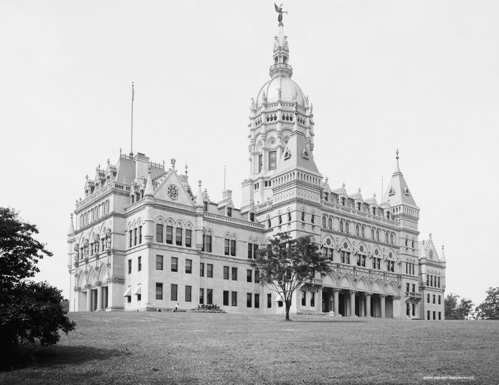
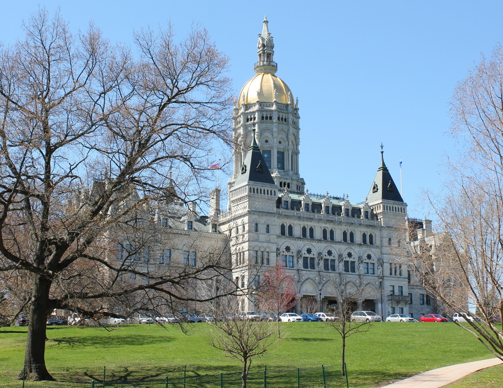
For many years, Connecticut had a rather unusual capital city arrangement. Despite being geographically one of the smallest states, they had two capital cities: Hartford and New Haven. The General Assembly alternated locations, thus accommodating both the section of the state along the coastline, as well as those who lived further inland.  The state even had two different state houses, with one in each city. This was presumably beneficial for travel when the system was established in 1701, but by the second half of the 19th century railroads made the 35 miles between the two cities far more manageable. It was impractical to continue to have two different capitals (not to mention two different capitols), so in 1875 Hartford became the sole capital city.

To commemorate the unification of the capitals, Connecticut built a new state capitol at the southern end of Bushnell Park, and it has been the seat of Connecticut government ever since.  The only readily apparent change between the two photos is the statue on top of the dome. Called The Genius of Connecticut, it was damaged in the 1938 Hurricane and taken down; several years later it was melted down as scrap metal for the war effort. In front of the building, Bushnell Park is still there, albeit with more trees and substantially more parking spaces than in the 1906 scene.

Stockbridge Street, Springfield Mass

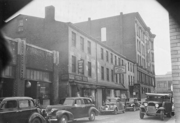
Looking east on Stockbridge Street toward Main Street in Springfield, around 1938-1939. Image courtesy of the Springfield Preservation Trust.

510_1938-1939 spt

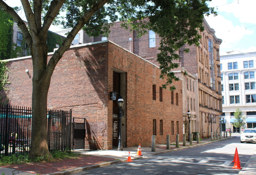
Stockbridge Street in 2023:

Like many other places in downtown Springfield, Stockbridge Street was once lined with three story brick commercial blocks, much like the ones seen in the 1930s view of the street.  This style appeared throughout the downtown area in the first half of the 19th century, when Springfield began growing into a major commercial and industrial center.  Early views of Court Square, Main Street, and other areas in downtown all feature plenty of examples of these buildings, but today only a few are left.  In the immediate downtown area, the last two are the Byers Block on Court Square, and the Guenther & Handel’s Block in this scene.

The Guenther & Handel’s Block was built in 1845, and as the 1930s photo shows, it was part of a row of similar buildings.  For many years, the ground floor was a grocery store and delicatessen, and in 1913 was sold to Emil Guenther and Richard Handel, who ran a grocery store under their names.  By the time the first photo was taken, both men had died, but the business was run by the family until 1972.  Today, all of the other mid-19th century buildings on the street are gone, and Guenther & Handel’s Block is wedged between an ornate early 20th century apartment building and a drab, nondescript late 20th century commercial building.

Old Corner Bookstore, Springfield Mass

Springfield’s Old Corner Bookstore at the corner of Main and State Streets, around 1892. Image from Picturesque Hampden (1892).

509_1892c picturesquehampden

The scene in 2023:

Not to be confused with the more famous Old Corner Bookstore in Boston,this was never a gathering place for prominent 19th century authors, but the building did play a significant role in American literary history.  The building was built in 1834, and a year later George and Charles Merriam opened up a bookstore.  At first, they printed law books, Bibles, and other books, but they gained prominence after 1843, when they purchased the rights to Noah Webster’s dictionary.  By the time the first photo was taken, the company had moved directly across Main Street.  Today, the company is still in business, as Merriam-Webster, and their headquarters are still in Springfield, on Federal Street.

As for the building itself, it continued to be used as a bookstore and for publishing, even after the Merriams moved.  Around 1871, James L. Whitney and W. F. Adams took over the bookstore, and sold everything from blank stationery to school textbooks.  In 1884, King’s Hanbook of Springfield gave the business a glowing review, declaring that “The success of this house is largely due to the straightforward and honorable policy by which their affairs ever have been and are now conducted.”  The statement was likely made in all sincerity, too, since King’s Handbook of Springfield was published by one of their Springfield competitors, publisher James D. Gill.

Irrespective of their “straightforward and honorable” nature, however, the bookstore went out of business in 1894, and the building became home to the Old Corner Wall Paper Company.  The old building was demolished sometime between then and 1927, when the Shean Block seen in the present day photo was built.  The only building that can be seen in both photos is the Hampden County Courthouse; the top of the tower can be seen in the distance in the left center, between the chimneys in the 1892 photo and behind the Court Square Hotel today.

Old Church and Courthouse, Northampton, Mass

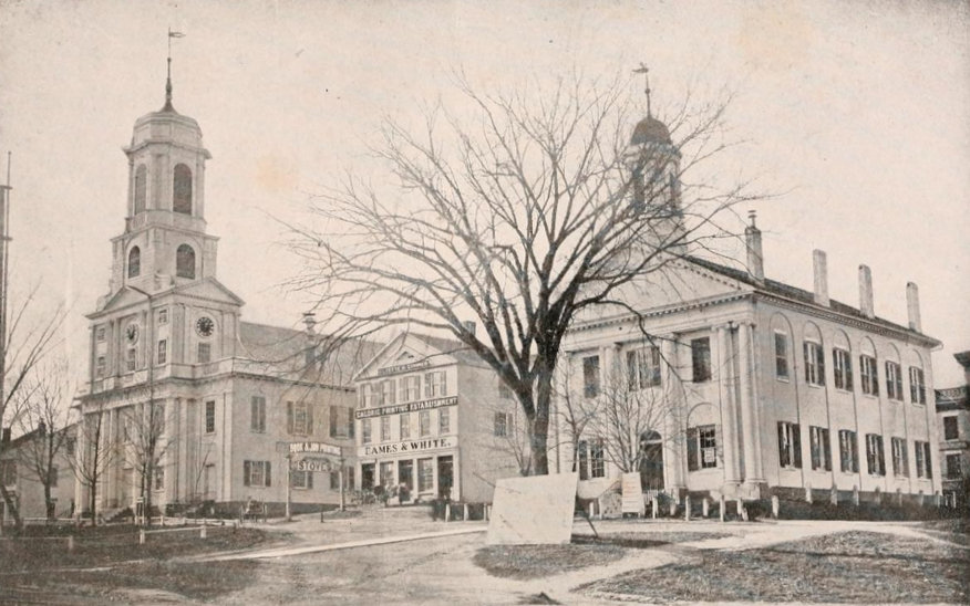
Looking up Main Street from Pleasant Street in Northampton, toward the old church and courthouse in 1864. Photo from Reminiscences of Old Northampton (1902).
508_1864 reminiscencesofoldnorthampton

The location in 2018:

The 1864 photo is one of the oldest existing photographs of downtown Northampton, and none of the buildings from that scene survive today, 151 years later.  To the left in the 1864 photo is the old church, which was built in 1812.  It was Northampton’s fourth meeting house, and it replaced the 1737 building that had been built during the pastorate of Jonathan Edwards.  It was from here that the influential pastor and theologian helped to spark the Great Awakening revival that spread across the American colonies and in Europe, but by the turn of the century the town was in need of a new building.  The 1812 church was designed by Northampton architect Isaac Damon, who just a few years later would design Old First Church in Springfield, 15 miles to the south.  However, while Old First Church survives to this day, the Northampton church seen in the 1864 photo burned in 1876, and was replaced two years later by the current brownstone church.

On the far right of the 1864 photo is the old Hampshire County Courthouse.  I don’t know when it was built, but it is virtually identical to the 1821 Hampden County Courthouse, seen on the far left of the 1882 photo in this post.  Because of its similar appearance, the Hampshire County Courthouse was probably built around the same time, shortly after some major changes to the county’s borders.  Originally, Hampshire County included all of Western Massachusetts, but it was steadily broken up into multiple counties, beginning in 1761 when Berkshire County was established to the west.  Then in 1811, Franklin County was created in the northern part of the Connecticut River Valley with Greenfield as the county seat, and a year later Hampden County split off to the south, with Springfield as the county seat.  I don’t know what happened to the old courthouse seen here, but it was gone by 1886, when the present-day Hampshire County Courthouse opened on roughly the same spot at the corner of Main and King Streets.

In between the two prominent buildings in the 1864 scene is a relatively small commercial block, the Whitney Building.  The photograph was actually commissioned by George D. Eames, the owner of the building, and was probably intended to advertise the building’s prominent location in town.  Part of the building housed the offices of the Hampshire Gazette, and the newspaper was published in the basement.  This is evidently the reason for the large sign on the building that reads “Caloric Printing Establishment.”  The Whitney Building was demolished in 1876, and a bank building was put in its place.  Today, the 1916 Northampton Institute for Savings building occupies the site where the Whitney Building once stood.